Social Media Map – Location-based Insights
Why a Social Media Map Matters
Social media conversations are valuable sources of information, but equally as important can be where they are taking place. Location data provides critical insight that can help public safety organizations, researchers, school administrators, marketers and many others find exactly what they need to take action, saving time, resources and even lives. It’s not enough to only know the what and the when. You have to know the where.
A social media map can be twofold — it acts as a social media reference guide that applies an organized and categorized view to a rapidly expanding landscape of sites and applications and it can also be a graphical representation of where social media conversations and posts are happening using location-based social media applications.
While some social media sites allow users to tag their posts with their current location, either with the venue or exact GPS coordinates, the majority of social media posts are lacking explicitly-tagged geographic information. Even when location information is included, looking at raw social media data can be difficult, particularly when you consider the massive volume of data generated via social media.
Social Media Maps Have Their Benefits:
- Easy viewing: Social media maps provide a much easier visual representation of data, making visualizing patterns and networks much simpler.
- Accurate picture: When the content of conversations is combined with the precise locations of those conversations, a more complete picture emerges. No matter your industry or purpose for social media monitoring, you can be much more effective when you have both bits of information.
- Better understanding: If you are referencing a social media map to see all the various social media platforms currently available, the map puts it all on one page so you can begin to make sense of it. Social platforms are increasing in number daily and if your organization wants to understand where it can get the most leverage, you must understand who the key players are at any given time.
Snaptrends’ Social Media Map
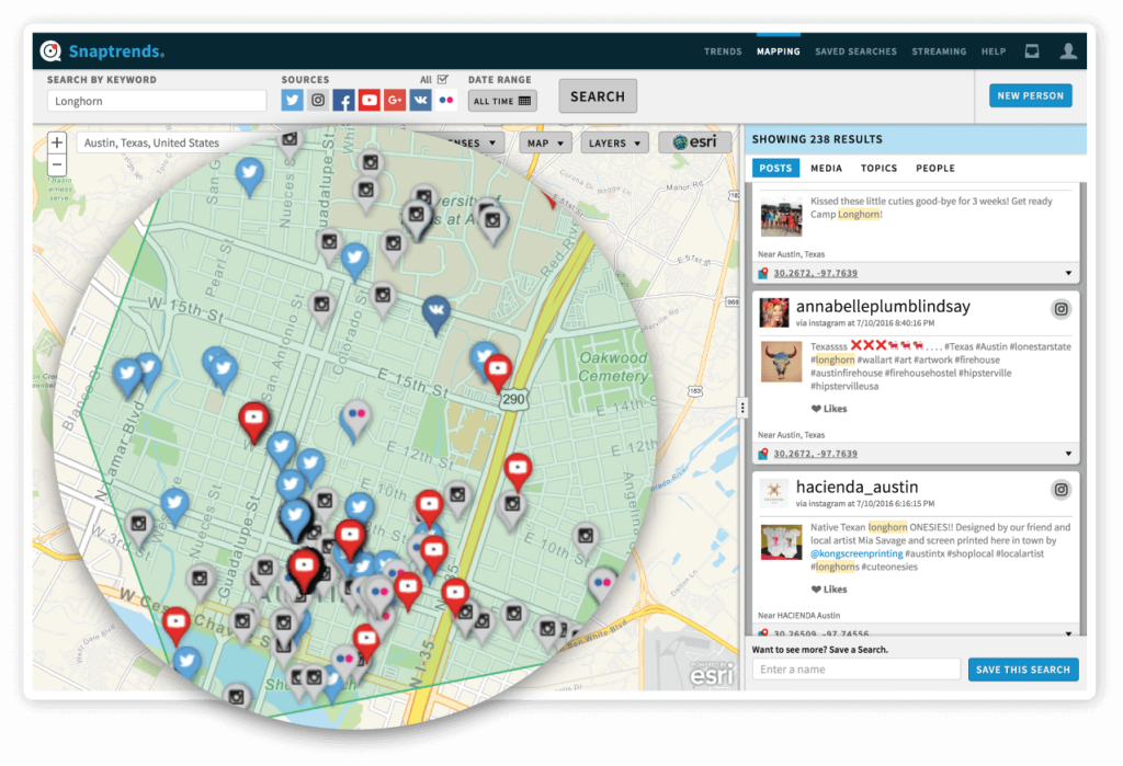
Snaptrends offers a suite of data visualization tools such as a social media map, so you can incorporate a variety of mapping overlays, including heat maps and activity clusters, demographics, weather radar, and emergency watches into your research. The social media map viewing options allow you to locate posts on a standard map, satellite view or street view.

Snaptrends lets you see where social media posts are originating with numerous mapping options
This level of detail enables organizations to not only understand the conversations but also identify networks, specific areas of activity and their relation to one another, surrounding factors such as neighborhoods, schools and topography, and even environmental components like an impending storm. When you see everything laid out on a social media map, you can quickly identify patterns and relationships to make better-informed decisions.
